The National Library of Montenegro “Đurđe Crnojević” is continuously engaged in completing the “Montenegrina” collection with missing copies of library materials that are scattered all over the world. After the three incunabula of Andrija Paltašić from the end of the 15th century, the Library's holdings have been enriched with old and rare copies of books and geographical maps.
Among them, we highlight the post-incunabula “Iulii Camilli Molsae et aliorum illustrium poetarum carmina” in Latin by Ljudevit Paskvalić from Kotor (Venice, 1551), whose poetry represents the most developed expression of Renaissance Kotor.
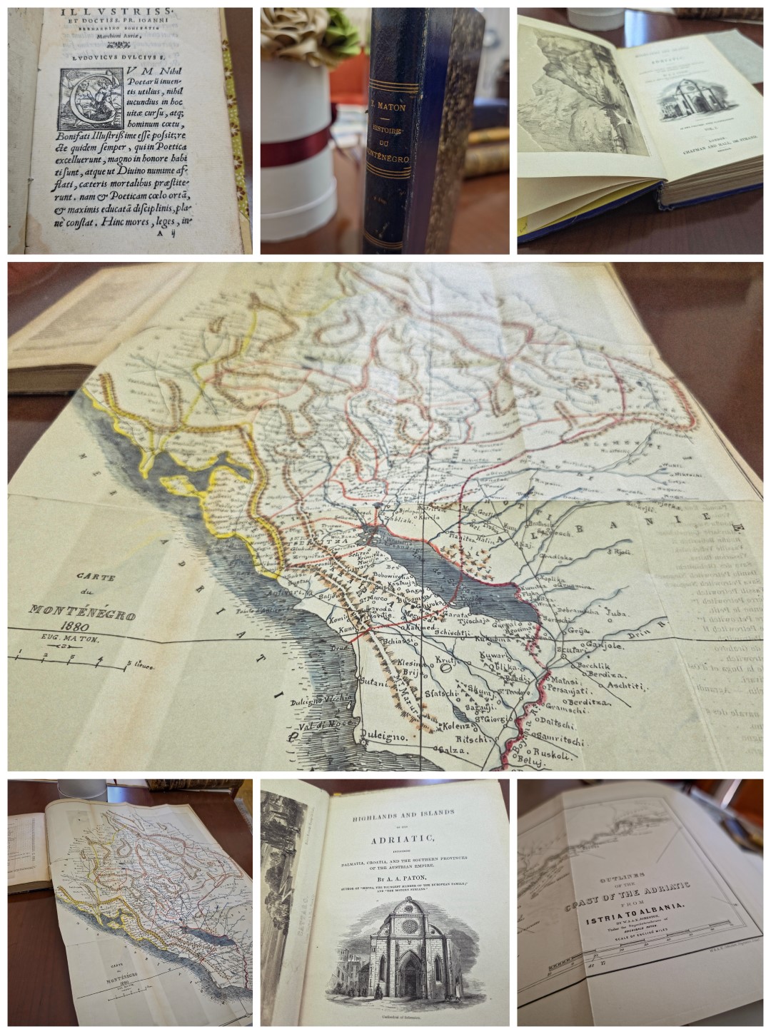
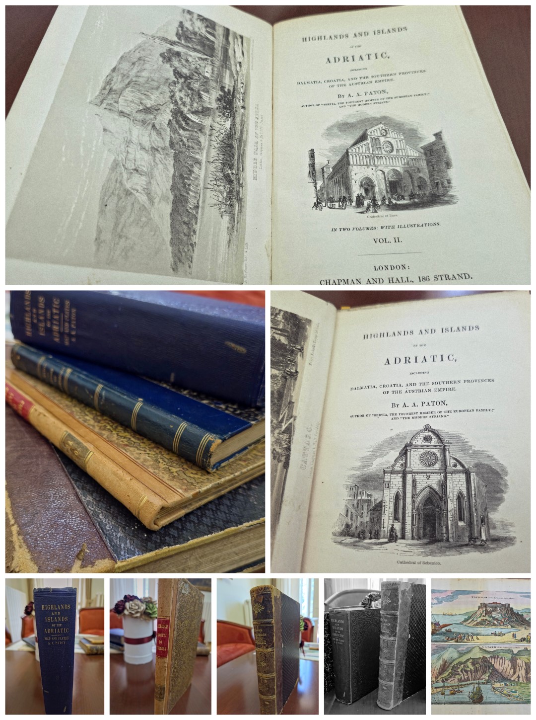
There are also works by Spiridon Gopčević “Makedonien und Alt-Serbien”, with 8 extremely valuable geographical maps (Vienna, 1889), “I conti di Tuhelj” by Josip Đelčić (Gjelčić) (Dubrovnik, 1890), “Highlands and Islands of the Adriatic, including Dalmatia, Croatia, and the southern provinces of the Austrian Empire”, Volume I-II, by E. Paton (London, 1849). The work contains 14 vedute (pictures) and 1 large map of the eastern coast of the Adriatic from Rijeka to Budva. The work by E. Maton “Histoire du Monténégro ou Tsernogore” (Paris, 1881), which also contains a wonderful geographical map of Montenegro (Carte du Monténégro 1880), belongs to the rare editions. Maton dedicated this work to the Montenegrin prince Nikola: "Dédié a son altesse le prince Nikita Petrowitch, souverain du Monténégro".
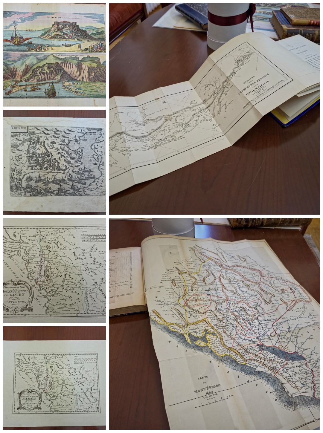
The NBCG also enriched its cartographic-geographical collection with the "Castel Nuovo" (Venice, 16th century) veduta/geographical map. It shows the siege of Herceg Novi, and the map shows Perast, Risan and in the upper right corner Kotor (Citta di Cataro). The author is Giovanni Francesco Camocio, a famous Venetian cartographer and publisher. Then, a geographical map called “Der Noerdliche Theil Koenigreichs Albanien mit dem Distriktite Montenegro” (Map of Northern Albania and Montenegro), made by Joseph von Reilly at the end of the 18th century. We will also mention the map “Novigrado [et] Cataro” (Amsterdam, 1701). The author is Pierre Mortier, a Dutch publisher and engraver.
Apart from these, some contemporary editions published abroad which refer to Montenegro and belong to the “Montenegrina” collection were bought as well.


The National Library of Montenegro “Đurđe Crnojević” is continuously engaged in completing the “Montenegrina” collection with missing copies of library materials that are scattered all over the world. After the three incunabula of Andrija Paltašić from the end of the 15th century, the Library's holdings have been enriched with old and rare copies of books and geographical maps.
Among them, we highlight the post-incunabula “Iulii Camilli Molsae et aliorum illustrium poetarum carmina” in Latin by Ljudevit Paskvalić from Kotor (Venice, 1551), whose poetry represents the most developed expression of Renaissance Kotor.
There are also works by Spiridon Gopčević “Makedonien und Alt-Serbien”, with 8 extremely valuable geographical maps (Vienna, 1889), “I conti di Tuhelj” by Josip Đelčić (Gjelčić) (Dubrovnik, 1890), “Highlands and Islands of the Adriatic, including Dalmatia, Croatia, and the southern provinces of the Austrian Empire”, Volume I-II, by E. Paton (London, 1849). The work contains 14 vedute (pictures) and 1 large map of the eastern coast of the Adriatic from Rijeka to Budva. The work by E. Maton “Histoire du Monténégro ou Tsernogore” (Paris, 1881), which also contains a wonderful geographical map of Montenegro (Carte du Monténégro 1880), belongs to the rare editions. Maton dedicated this work to the Montenegrin prince Nikola: "Dédié a son altesse le prince Nikita Petrowitch, souverain du Monténégro".
The NBCG also enriched its cartographic-geographical collection with the "Castel Nuovo" (Venice, 16th century) veduta/geographical map. It shows the siege of Herceg Novi, and the map shows Perast, Risan and in the upper right corner Kotor (Citta di Cataro). The author is Giovanni Francesco Camocio, a famous Venetian cartographer and publisher. Then, a geographical map called “Der Noerdliche Theil Koenigreichs Albanien mit dem Distriktite Montenegro” (Map of Northern Albania and Montenegro), made by Joseph von Reilly at the end of the 18th century. We will also mention the map “Novigrado [et] Cataro” (Amsterdam, 1701). The author is Pierre Mortier, a Dutch publisher and engraver.
Apart from these, some contemporary editions published abroad which refer to Montenegro and belong to the “Montenegrina” collection were bought as well.